|
| Realising the GIS database with persons and institutions responsible for land management |
|
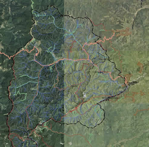
Based on the Territorial Planning Schemes and on information provided by land administrators, started the activity of identifying landowners, the obtained data being offered to the University of Bucharest, which integrated it in a GIS database. The GIS database serves at a real time evaluation of the events from the Natura 2000 sites, of identifying landowners and managers for debating the management plans, of offering support to control authorities complying with the environmental legislation and increasing the awareness of landowners and managers upon the existence of the Natura 2000 sites.
The database has two modules: :
- An offline module for GIS and desktop (compatible with any software that visualises shape file formats),
- An online module (with the help of the Manifold application, installed on a server at EPA Vrancea).
The database consists of: polygon layer – Natura 2000 sites limits; point layer – altitudes; raster layer – hypsometry; point layer – shooting box, forestry cabin, feeding facilities, sheepfolds, etc; line layer – roads (forestry, village, county, national); line layer – rivers; polygon layer – lakes; polygon layer – CORINE land cover categories; polygon layer – land use categories based on compresses aero-photogram SID 2004; polygon layer – forestry parcels, owners and managers, corrected by aero-photogram; polygon layer – landowners; polygon layer – tourism facilities; polygon layer – localities; point layer – authorised exploitation packets. .
Each layer has interrogation attributes, making possible the real time documentation upon the situation in the Natura 2000 sites.. |
|